Tsholotsho, originally known as Tjolotjo, is a district located in the Matabeleland North province of Zimbabwe.
The administrative centre, Tsholotsho Business Centre, is approximately 98 km northwest of Bulawayo.
Surrounded by Lupane, Hwange, Umguza, and Bulilima districts, Tsholotsho holds historical significance, rich cultural heritage, and a diverse geographical landscape.
ALSO READ: Tsumo dzeChiShona Dzinotanga naR, S, T, U
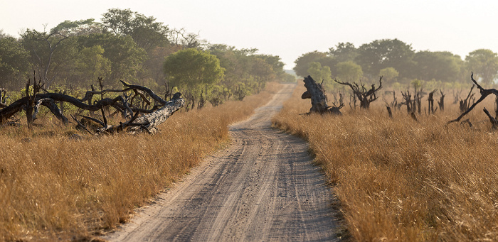
 Exploring Tsholotsho: PICTURE credit to Erde
Origins of the Name
The name “Tsholotsho” has its roots in the San language, with “Tsoro o tso” meaning the head of an elephant.
This terminology reflects the district’s historical connection with vast elephant herds and early ivory hunters.
The name Tsholotsho, formerly known as Tjolotjo, has a fascinating origin linked to the region’s history and its elephant population. Here are the two main theories:
1. Derived from the San word for “elephant head”:
- This theory suggests the name comes from the San word “Tsoro o tso,” which translates to “head of an elephant.” Historically, the area was known for its large elephant herds, attracting early ivory hunters. The San people, who inhabited the region before the Ndebele’s arrival, likely named it based on this prominent feature.
2. Adopted by the Ndebele:
- While the name may have originated with the San, it was adopted by the Ndebele people when they arrived in the area around 1838. King Mzilikazi, impressed by the vast grazing lands, made Tsholotsho a key part of his kingdom. They retained the existing name, possibly due to its connection to the abundant elephants.
Additional points to consider:
- Though adopted by the Ndebele, some sources say the meaning changed to “place of elephants” in their language.
- The origin of the nickname “Iziqholo zeZhwane” for Tsholotsho people, meaning “rocks of iron,” remains unclear but might allude to their resilience and strength.
- Tsholotsho’s distinct cultural identity, often described as a “country within a country,” reflects its rich history and diverse influences.
Overall, the name Tsholotsho carries a strong connection to the region’s history and its relationship with elephants.
Whether directly rooted in the San language or adopted and reinterpreted by the Ndebele, it serves as a reminder of the area’s unique natural heritage and cultural significance.
ALSO READ: Journey Through Matobo: A Deep Dive into Zimbabwe’s Scenic Wonder
History

Exploring Tsholotsho: Picture credit to Dominic Winter
Tsholotsho’s history dates back to the occupation by the Bakalanga and San people before the arrival of Mzilikazi and the Ndebele community.
The district witnessed pre-Mzilikazi chiefs, including Tategulu, Makulukusa, and Madlangombe.
Initially part of the Kingdom of Butua, it later became part of the Rozvi Empire. Mzilikazi, enamoured by the expansive grazing land, left it under the leadership of his trusted paramount chief, Maqhekeni Sithole.
The history of Tsholotsho is rich and layered, stretching back centuries and encompassing various communities and rulers. Here’s a timeline highlighting some key moments:
Pre-colonial era:
- Before 1838: The area was inhabited by the Bakalanga people, with archaeological evidence suggesting settlements dating back hundreds of years. The San people also had a presence, known for their nomadic hunting and gathering lifestyle. Tsholotsho was part of the Kingdom of Butua and later the Rozvi Empire.
- Etymology of the name: The name “Tsholotsho” (originally “Tjolotjo”) likely originates from the San word “Tsoro o tso,” meaning “head of an elephant,” reflecting the region’s abundance of these animals.
Arrival of the Ndebele:
- 1838: King Mzilikazi and his Ndebele people arrive in the region, fleeing conflict in South Africa. Impressed by the natural resources and vast plains, they make Tsholotsho a prominent part of their kingdom.
- Cultural fusion: While the Ndebele adopt the name “Tsholotsho,” their arrival leads to a blending of cultures and traditions. The Ndebele introduce their military and political structures while incorporating elements of the Bakalanga way of life.
Colonial period:
- Late 19th century: European colonization disrupts the Ndebele kingdom, leading to conflicts and ultimately, the incorporation of Tsholotsho into British Rhodesia.
- Land dispossession and marginalization: Under colonial rule, indigenous communities lose access to land and resources, facing social and economic challenges.
Post-independence and beyond:
- 1980: Zimbabwe gains independence, aiming to address some of the inequalities from the colonial past. However, Tsholotsho still faces development challenges and economic opportunities can be limited.
- Resilient community: Despite facing obstacles, the people of Tsholotsho maintain their cultural identity and traditions. They actively participate in cultural activities, music, and storytelling, keeping their heritage alive.
Contemporary issues:
- Transnational migration: Like many areas in Zimbabwe, Tsholotsho experiences outward migration, with people seeking better opportunities in South Africa and beyond. This affects families and communities but also brings back remittances that play a vital role in the local economy.
- Conservation efforts: Recognizing the importance of its natural heritage, Tsholotsho has initiatives focused on wildlife conservation and sustainable resource management. These efforts contribute to ecotourism and protect the unique environment.
Culture
Most villages in Tsholotsho bear pure Bakalanga names, reflecting the cultural heritage of the region.
The district is home to three ethnic groups: Ndebele, Kalanga (along the Manzamnyama River), and the San (closer to the Hwange National Park), with the principal language being Ndebele.
Tsholotsho boasts a vibrant and diverse culture, shaped by its rich history, diverse communities, and ongoing interaction with the environment. Here’s a glimpse into some key aspects:
1. Traditions and ceremonies:
- Umthondo: This initiation ceremony for young men marks their transition to adulthood and involves cultural teachings, physical challenges, and community integration.
- Izimbongi: Traditional praise poetry praises individuals, chiefs, or spirits, showcasing storytelling skills and historical knowledge.
- Amasango: Traditional dances express cultural narratives, emotions, and community spirit.
- Ukuxola: Traditional healing practices incorporate herbal remedies and spiritual beliefs.
2. Art and music:
- Beadwork: Women are renowned for their intricate beadwork designs, adorning clothing, accessories, and ceremonial attire.
- Carving and sculpture: Skilled artisans create wooden sculptures depicting animals, spirits, and everyday objects.
- Imbube: A vocal music style characterized by close harmonies and uplifting melodies, often accompanied by clapping and stomping.
- Jeka: Storytelling traditions keep history, folklore, and cultural values alive through captivating narratives.
3. Food and agriculture:
- Traditional crops: Sorghum, millet, and maize are stapled foods, often prepared as sadza (maize meal porridge) or marimba (fermented sorghum beer).
- Indigenous vegetables: Wild and cultivated vegetables like chicha (amaranth), inkonjane (spider plant), and madhumbe (wild berries) enrich the diet.
- Livestock: Cattle, goats, and chickens are valued sources of meat and milk, also playing a role in cultural rituals.
4. Religion and spirituality:
- Christianity: Introduced by missionaries, various Christian denominations hold a significant presence.
- Indigenous beliefs: Traditional beliefs regarding ancestral spirits, natural forces, and diviners coexist with Christianity in some communities.
5. Contemporary influences:
- Globalization: Exposure to modern media and technology introduces new trends and ideas, influencing younger generations.
- Urban migration: While challenges exist, remittances from family members working in cities support local communities.
- Tourism: Growing eco-tourism initiatives showcase cultural practices and natural beauty, fostering cultural exchange.
ALSO READ: Top 10 Japanese Cars for Under $4000 in Zimbabwe (Manufactured After 2013)
Geographical Location
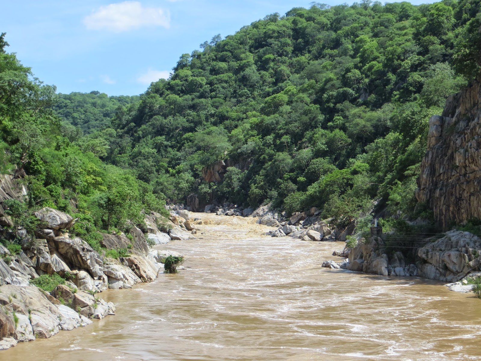
 Exploring Tsholotsho: Picture credit to Mlibizi
Tsholotsho is strategically located, bordered by the Manzamnyama River, Gwayi River, and Hwange National Park.
The district boasts a diverse geography, including Kalahari Sands, Gwayi River floodplain with rich black clay soils, and south-eastern areas with red clay soils.
The Tsholotsho area is located in Matabeleland North province in Zimbabwe. Here are some details about its geographical location:
- District: Tsholotsho is a district within Matabeleland North province.
- Administrative centre: The main town or centre of the district is also called Tsholotsho.
- Distance from major cities:
- Approximately 98 kilometres northwest of Bulawayo, the second-largest city in Zimbabwe.
- Approximately 446 kilometres southwest of Harare, the capital city of Zimbabwe.
- Coordinates: The approximate coordinates of Tsholotsho town are 19°40’S 27°52’E.
- Surrounding districts: Neighboring districts include Lupane, Hwange, Umguza, and Bulilima.
- Landscape: The district is characterized by rolling hills, savanna grasslands, and scattered granite outcrops.
- Rivers: Major rivers flowing through the district include the Gwayi River and the Manzamnyama River.
Schools in Tsholotsho
Historically, Tsholotsho has been associated with educational institutions. An industrial school was founded in 1921, emphasizing agricultural education.
The district also witnessed the establishment of Esikhoveni Agricultural Institute, contributing to the development of agricultural practices.
Schools in Tsholotsho, Zimbabwe
Tsholotsho boasts a variety of educational institutions catering to different age groups and needs. Here’s an overview of some prominent schools in the area:
Primary Schools:
Bembe Primary School: Located along Dlamni-Sodaka Road, it provides foundational education for young learners.
Butabubili Primary School: Situated along Garia Road, it offers primary education in a rural setting.
- Chefunye Primary School: Found at Matshabgna Business Centre in Ward 19, it caters to primary-age children.
Dhlacapiya Primary School: Located on Chief Tatefulu’s land in Ward 9 Sodaka Road, it provides essential primary education.
Gwaai Primary School: Situated in Ward 5 Mkhehwa Village, it serves the educational needs of young students.
Tsholotsho High School: One of the most established secondary schools in the district, offering education beyond the primary level.
Secondary Schools:
- Khumbula High School: A Brethren-In-Christ Church-run boarding school known for its academic excellence, located in Ward 7.
Maga Secondary School: Situated in Magana Secondary Ward 13 under Chief Magama, it provides secondary education opportunities.
Mate Secondary School: Found in Ward 18 southeast of Tsholotsho Centre, it caters to secondary-age learners.
Mavela High School: Located close to Tsholotsho Business Centre, it offers a secondary education curriculum.
Mbalibali Secondary School: Situated in Mbalibali Village, it provides educational opportunities for students in the community.
Sipepa High School: Commonly known as Sipepa Secondary School, it’s located within Tsholotsho and offers secondary education.
- Tshabanda Adventist High School: Situated along Bulawayo-Sikente Road, it’s a Seventh-day Adventist Church-run secondary school.
Additional Information:
- This list is not exhaustive, and several other schools cater to different educational needs in Tsholotsho.
- The specific facilities, programs, and enrollment details may vary for each school.
- For more information on a particular school, it’s recommended to contact the school directly or visit the Ministry of Education’s website.
ALSO READ: Get To Know NyamapandaGet To Know Nyamapanda
Council Contacts
For matters related to the Tsholotsho Rural District Council, individuals can contact the council at Lupane, Zimbabwe, using the provided contact number: 089 8390.
Police Contacts
Tsholotsho Police Station can be reached at the following telephone numbers: 0387-217, 0387-267, 0387-205.
Economy
The primary economic activity in Tsholotsho is farming, with challenges posed by soil conditions. Efforts have been made to explore alternatives such as ecotourism in the Hwange National Park. The district faces economic challenges, evident in the significant migration to South Africa for employment opportunities.
Transport and Communication
Tsholotsho District features a road network, including a tarred road connecting to Bulawayo. However, extensive Kalahari sands limit road usability. Though challenging, the district’s road system forms a surprisingly sophisticated web connecting various villages.
Government and Politics
Tsholotsho has played a notable role in Zimbabwean politics, marked by events like the Tsholotsho Declaration of 2005. The district has witnessed shifts in political representation, reflecting the dynamic nature of Zimbabwean politics.
References
- Tsholotsho District – Wikipedia
- Published by Wikipedia, Last updated [Date]
- Tsholotsho South – Chapungu Kambako
- Published by [Author], [Date]
- Tsholotsho Police Station – Search.co.zw
- Published by [Author], [Date]
- Tsholotsho Rural District Council – Visible Directory
- Published by [Author], [Date]